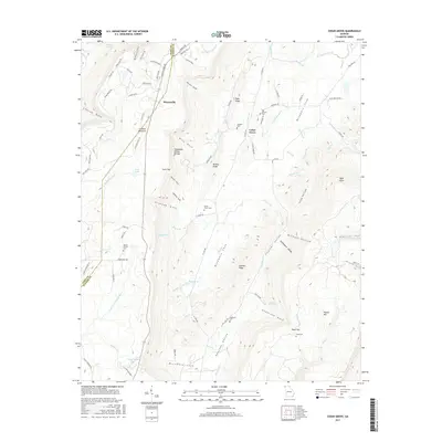
2017 Map of Cedar Grove
USGS Topo · Published 2017About this map
Masseyville and Cedar Grove anchor this 2017 study of the high-elevation terrain where Lookout Mountain and Pigeon Mtn converge. The landscape is defined by its deep gaps and gulfs, such as Hise Gulf and McWhorter Gulf, which have historically dictated the placement of roads and small communities. The agricultural and residential settlement pattern is concentrated within the protected confines of McLemore Cove and the Hogjowl Valley, where numerous family and community burial sites are maintained, including Old Antioch Cem and Rape Cem.
Find a feature on this map
103 named features on this map. Tap any name to fly to it.
Don’t see what you’re looking for? This feature index may not catch every label — zoom into the map to look around manually.
Map Details
Editions of this 2017 Cedar Grove Map
This is the sole edition of this map. No revisions or reprints were ever made.
Other maps of this area

1886 · Ringgold
USGS Topo · 1:125,000

1886 · Stevenson
USGS Topo · 1:125,000

1892 · Ringgold
USGS Topo · 1:125,000

1892 · Stevenson
USGS Topo · 1:125,000

1895 · Stevenson
USGS Topo · 1:125,000

1935 · Durham
USGS Topo · 1:24,000

1936 · Trenton
USGS Topo · 1:24,000

1936 · Kensington
USGS Topo · 1:24,000

1936 · Sulphur Springs
USGS Topo · 1:24,000

1936 · Estelle
USGS Topo · 1:24,000