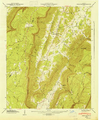
1947 Map of Cedar Grove
USGS Topo · Published 1947About this map
McLemore Cove defines the central topography of this 1946 field-examined landscape, where agricultural settlements are concentrated between the high elevations of Lookout Mountain and Pigeon Mountain. The survey reveals a community organized around family names and rural institutions, particularly near Cedar Grove, which serves as a local hub with its own church and multiple cemeteries. The western slopes are characterized by numerous deeply cut drainages known as gulfs, including Tatum Gulf and McKaig Gulf, illustrating the sharp descent from the plateau into the Tennessee Valley. Genealogists will find significant value in the distribution of family-named burial grounds such as Thurman Cem and Anderson Cem, as well as the proximity of small settlements like Masseyville and Moore. This map documents a period before modern development, capturing the original road networks and the location of isolated churches like Antioch Ch and Mt Carmel Ch that anchored these upland communities.
Find a feature on this map
65 named features on this map. Tap any name to fly to it.
Don’t see what you’re looking for? This feature index may not catch every label — zoom into the map to look around manually.
Map Details
Editions of this 1947 Cedar Grove Map
2 editions found
Other maps of this area

1886 · Ringgold
USGS Topo · 1:125,000

1886 · Stevenson
USGS Topo · 1:125,000

1892 · Ringgold
USGS Topo · 1:125,000

1892 · Stevenson
USGS Topo · 1:125,000

1895 · Stevenson
USGS Topo · 1:125,000

1935 · Durham
USGS Topo · 1:24,000

1936 · Trenton
USGS Topo · 1:24,000

1936 · Kensington
USGS Topo · 1:24,000

1936 · Sulphur Springs
USGS Topo · 1:24,000

1936 · Estelle
USGS Topo · 1:24,000