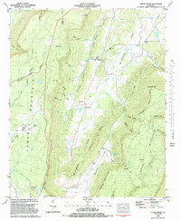
1982 Map of Cedar Grove
USGS Topo · Published 1983About this map
McLemore Cove defines the central landscape of this Northwest Georgia survey, where the valley floor is punctuated by the small settlement of Cedar Grove. The terrain is characterized by steep, parallel ridges including Shankle Ridge and Roland Ridge, which separate the cove from the high plateau of Pigeon Mountain to the east and Lookout Mountain to the west. This mapping of Walker and Dade counties reveals a dispersed network of rural heritage sites, including family-named landmarks like McWhorter Gulf and Rape Gap.
Find a feature on this map
70 named features on this map. Tap any name to fly to it.
Don’t see what you’re looking for? This feature index may not catch every label — zoom into the map to look around manually.
Map Details
Editions of this 1982 Cedar Grove Map
This is the sole edition of this map. No revisions or reprints were ever made.
Other maps of this area

1886 · Ringgold
USGS Topo · 1:125,000

1886 · Stevenson
USGS Topo · 1:125,000

1892 · Ringgold
USGS Topo · 1:125,000

1892 · Stevenson
USGS Topo · 1:125,000

1895 · Stevenson
USGS Topo · 1:125,000

1935 · Durham
USGS Topo · 1:24,000

1936 · Trenton
USGS Topo · 1:24,000

1936 · Kensington
USGS Topo · 1:24,000

1936 · Sulphur Springs
USGS Topo · 1:24,000

1936 · Estelle
USGS Topo · 1:24,000