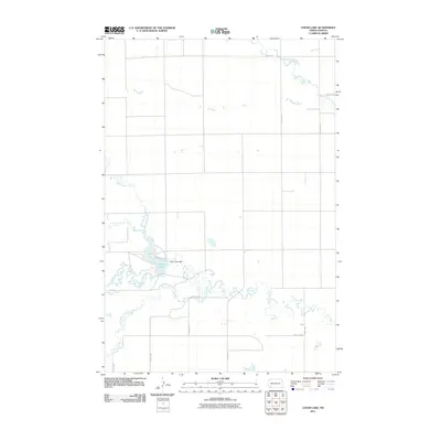
2011 Map of Cedar Lake
USGS Topo · Published 2011About this map
Cedar Lake serves as the central focal point for this landscape in Slope County, where the Cedar Lake Dam regulates the water levels of this significant prairie reservoir. The surrounding terrain is defined by a dendritic network of drainages, including the meandering paths of North Cedar Creek, South Cedar Creek, and the primary course of Cedar Creek. In the northeastern corner, Chanta Peta Creek cuts across the section lines, highlighting the typical township-and-range grid that dictates the local road network. These straight-line gravel roads, such as 18th Ave NW and 72nd St SW, reflect the enduring agrarian structure of the North Dakota plains, providing access to the expansive agricultural tracts that define the region's economy and social geography.
Find a feature on this map
17 named features on this map. Tap any name to fly to it.
Don’t see what you’re looking for? This feature index may not catch every label — zoom into the map to look around manually.
Map Details
Editions of this 2011 Cedar Lake Map
This is the sole edition of this map. No revisions or reprints were ever made.
Other maps of this area

1953 · Dickinson
USGS Topo · 1:250,000

1957 · Dickinson
USGS Topo · 1:250,000

1969 · Scranton NE
USGS Topo · 1:24,000

1973 · Warnke Hill
USGS Topo · 1:24,000

1973 · Cedar Lake
USGS Topo · 1:24,000

1973 · Jung Lake
USGS Topo · 1:24,000

1973 · West Rainy Butte
USGS Topo · 1:24,000

1973 · East Rainy Butte
USGS Topo · 1:24,000

1973 · Enterprise School
USGS Topo · 1:24,000

1980 · Mott
USGS Topo · 1:100,000