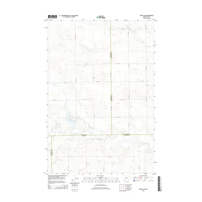
2014 Map of Cedar Lake
USGS Topo · Published 2014About this map
Cedar Lake lies at the heart of this North Dakota landscape, situated at the intersection of four counties. The reservoir is fed by N Cedar Cr and drained by Cedar Cr, which flows eastward across the terrain. This rural topography is defined by the borders of Slope, Hettinger, Adams, and Bowman counties, meeting in a series of surveyed lines that divide the open plains. A strictly gridded road network, including 77th St SW and 124th Ave SW, provides access to this sparsely populated region, illustrating the systematic land division characteristic of the Great Plains. The map also traces the winding course of Chanta Peta Cr in the northeast, highlighting the subtle drainage patterns that shape this agricultural and pastoral environment.
Find a feature on this map
25 named features on this map. Tap any name to fly to it.
Don’t see what you’re looking for? This feature index may not catch every label — zoom into the map to look around manually.
Map Details
Editions of this 2014 Cedar Lake Map
This is the sole edition of this map. No revisions or reprints were ever made.
Other maps of this area
1953 · Dickinson
USGS Topo · 1:250,000
1957 · Dickinson
USGS Topo · 1:250,000
1969 · Scranton NE
USGS Topo · 1:24,000
1973 · Warnke Hill
USGS Topo · 1:24,000
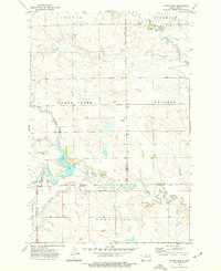
1973 · Cedar Lake
USGS Topo · 1:24,000
1973 · Jung Lake
USGS Topo · 1:24,000
1973 · West Rainy Butte
USGS Topo · 1:24,000
1973 · East Rainy Butte
USGS Topo · 1:24,000
1973 · Enterprise School
USGS Topo · 1:24,000
1980 · Mott
USGS Topo · 1:100,000