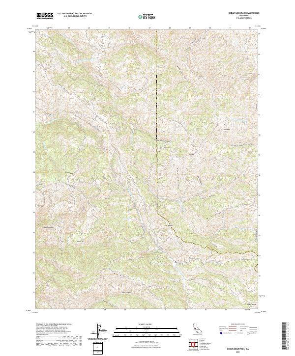
2021 Map of Cedar Mountain
USGS Topo · Published 2021About this map
The Diablo Range dominates this landscape along the border of Alameda and San Joaquin counties, where the complex topography of ridges and canyons defines the region's character. Significant infrastructure, notably the Hetch Hetchy Aqueduct, traverses the northern portion of the terrain, representing the critical water transport systems developed for the Bay Area. The presence of Mines Rd following the course of Arroyo Mocho suggests the historic transit and mining corridors that once linked these high ridges to the valleys below. Notable elevations such as Cedar Mtn and Mt Wallace rise above a network of drainages including Corral Hollow Cr and N Fork Lone Tree Cr, illustrating the rugged drainage patterns of the eastern hills. Small landmarks like Sweet Springs and the uniquely named Devils Pit offer specific points of interest for those tracing local geography and historical land use.
Find a feature on this map
31 named features on this map. Tap any name to fly to it.
Don’t see what you’re looking for? This feature index may not catch every label — zoom into the map to look around manually.
Map Details
Editions of this 2021 Cedar Mountain Map
This is the sole edition of this map. No revisions or reprints were ever made.
Other maps of this area

1897 · Mt. Hamilton
USGS Topo · 1:62,500

1907 · Tesla
USGS Topo · 1:62,500

1916 · Tracy
USGS Topo · 1:31,680

1916 · Midway
USGS Topo · 1:31,680

1922 · Carbona
USGS Topo · 1:62,500

1938 · Mt. Boardman
USGS Topo · 1:62,500

1942 · Mt. Hamilton
USGS Topo · 1:62,500
1942 · Carbona
USGS Topo · 1:62,500

1942 · Mt. Boardman
USGS Topo · 1:62,500

1942 · Altamont
USGS Topo · 1:62,500