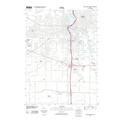
2010 Map of Cedar Rapids South
USGS Topo · Published 2010About this map
The Cedar River corridor and its industrial and cultural landmarks anchor this 2010 survey of southern Cedar Rapids. The landscape reveals a dense network of civic and memorial sites, notably the cluster of Bohemian Cemetery, Moslem Cemetery, and the Czech National Cemetery, reflecting the area's deep immigrant heritage near Czech Village. To the north, Municipal Island sits in the river adjacent to the Cedar Rapids Post Office, while the historic estate of Brucemore remains a prominent landmark in the city's northeast corner.
Find a feature on this map
73 named features on this map. Tap any name to fly to it.
Don’t see what you’re looking for? This feature index may not catch every label — zoom into the map to look around manually.
Map Details
Editions of this 2010 Cedar Rapids South Map
This is the sole edition of this map. No revisions or reprints were ever made.
Other maps of this area

1887 · Cedar Rapids
USGS Topo · 1:62,500

1888 · Shellsburg
USGS Topo · 1:62,500

1888 · Marion
USGS Topo · 1:62,500

1888 · Amana
USGS Topo · 1:62,500

1889 · Marion
USGS Topo · 1:62,500

1889 · Amana
USGS Topo · 1:62,500

1889 · Shellsburg
USGS Topo · 1:62,500

1891 · Cedar Rapids
USGS Topo · 1:62,500

1899 · Amana
USGS Topo · 1:62,500

1899 · Shellsburg
USGS Topo · 1:62,500
Featured Places
- Cedar Rapids, IA
- Summit, Cedar Rapids
- West Cedar Rapids, Cedar Rapids
- Worthington Acres, Cedar Rapids
- Linn County, IA