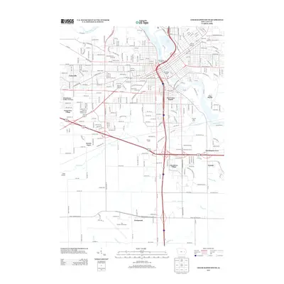
2013 Map of Cedar Rapids South
USGS Topo · Published 2013About this map
Municipal Island and the cultural hub of Czech Village anchor the urban core of this 2013 survey, where the Cedar River bends through the heart of the city. The landscape transitions from the dense residential grids of West Cedar Rapids and East Rapids to the expansive industrial and aviation corridors of the south. Significant institutional landmarks including Kirkwood Community College and The Eastern Iowa Airport define the southern reaches, while Hawkeye Downs serves as a major regional focal point for gathering and commerce.
Find a feature on this map
79 named features on this map. Tap any name to fly to it.
Don’t see what you’re looking for? This feature index may not catch every label — zoom into the map to look around manually.
Map Details
Editions of this 2013 Cedar Rapids South Map
This is the sole edition of this map. No revisions or reprints were ever made.
Other maps of this area

1887 · Cedar Rapids
USGS Topo · 1:62,500

1888 · Shellsburg
USGS Topo · 1:62,500

1888 · Marion
USGS Topo · 1:62,500

1888 · Amana
USGS Topo · 1:62,500

1889 · Marion
USGS Topo · 1:62,500

1889 · Amana
USGS Topo · 1:62,500

1889 · Shellsburg
USGS Topo · 1:62,500

1891 · Cedar Rapids
USGS Topo · 1:62,500

1899 · Amana
USGS Topo · 1:62,500

1899 · Shellsburg
USGS Topo · 1:62,500
Featured Places
- Cedar Rapids, IA
- Summit, Cedar Rapids
- West Cedar Rapids, Cedar Rapids
- Worthington Acres, Cedar Rapids
- Linn County, IA