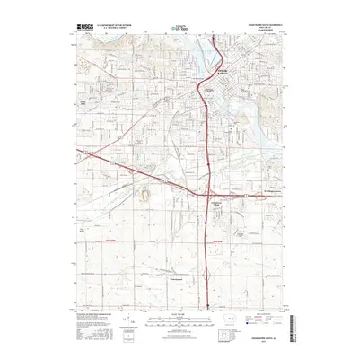
2015 Map of Cedar Rapids South
USGS Topo · Published 2015About this map
Cedar Rapids serves as the focal point of this 2015 study, where the Cedar River flows past Municipal Island and through a dense urban grid. This map reveals a significant concentration of cultural and educational sites, including Coe Coll in the north and the sprawling Kirkwood Community College campus to the south. The landscape is notably defined by a cluster of diverse burial grounds such as Linwood Cem, Bohemian Cem, and Moslem Cem, providing a detailed look at the community's multi-ethnic history and genealogy. Beyond the urban center, the terrain transitions into the outlying areas of Lincolnway Village and Worthington Acres. Large-scale infrastructure is prominent, anchored by The Eastern Iowa Airport and the convergence of regional waterways like Prairie Creek and Hoosier Creek.
Find a feature on this map
105 named features on this map. Tap any name to fly to it.
Don’t see what you’re looking for? This feature index may not catch every label — zoom into the map to look around manually.
Map Details
Editions of this 2015 Cedar Rapids South Map
This is the sole edition of this map. No revisions or reprints were ever made.
Other maps of this area

1887 · Cedar Rapids
USGS Topo · 1:62,500

1888 · Shellsburg
USGS Topo · 1:62,500

1888 · Marion
USGS Topo · 1:62,500

1888 · Amana
USGS Topo · 1:62,500

1889 · Marion
USGS Topo · 1:62,500

1889 · Amana
USGS Topo · 1:62,500

1889 · Shellsburg
USGS Topo · 1:62,500

1891 · Cedar Rapids
USGS Topo · 1:62,500

1899 · Amana
USGS Topo · 1:62,500

1899 · Shellsburg
USGS Topo · 1:62,500
Featured Places
- Cedar Rapids, IA
- Summit, Cedar Rapids
- West Cedar Rapids, Cedar Rapids
- Worthington Acres, Cedar Rapids
- Linn County, IA