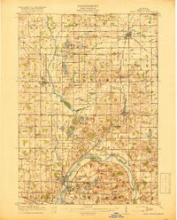
1918 Map of Cedar Springs
USGS Topo · Published 1918About this map
Grand River flows through the heart of this region during the First World War, carving a path through Kent County's developing townships. The landscape is defined by the convergence of industrial and agricultural life, where the Pere Marquette and Grand Rapids and Indiana railroads intersect at key hubs like Sparta and Cedar Springs. Along the river's lower reach, large-scale landmarks such as the West Michigan State Fairgrounds, the Soldiers Home, and the U S Rifle Range reflect the civic and military importance of the North Park and Comstock Park areas.
Find a feature on this map
120 named features on this map. Tap any name to fly to it.
Don’t see what you’re looking for? This feature index may not catch every label — zoom into the map to look around manually.
Map Details
Editions of this 1918 Cedar Springs Map
3 editions found
Other maps of this area

1914 · Grand Rapids
USGS Topo · 1:62,500

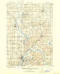
1918 · Cedar Springs
USGS Topo · 1:62,500

1918 · Lowell
USGS Topo · 1:62,500

1943 · Cedar Springs
USGS Topo · 1:62,500

1943 · Grand Rapids
USGS Topo · 1:62,500

1943 · Lowell
USGS Topo · 1:62,500

1945 · Ravenna
USGS Topo · 1:62,500

1954 · Midland
USGS Topo · 1:250,000

1958 · Midland
USGS Topo · 1:250,000

1958 · Grandville
USGS Topo · 1:62,500