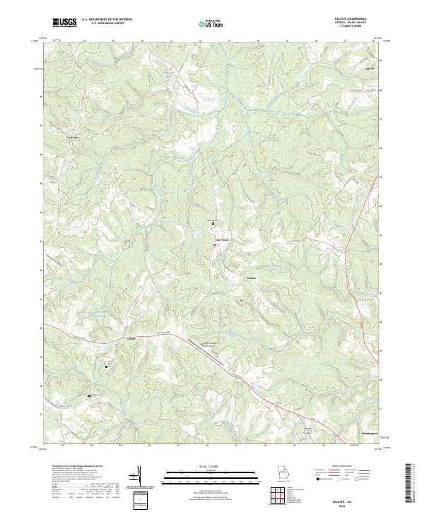
2024 Map of Celeste
USGS Topo · Published 2024About this map
New Town and Celeste anchor this rural Wilkes County landscape, where agriculture and small aviation meet in the Georgia Piedmont. The presence of several family or community burial grounds, including Newtown Cem and White Rock Cem, suggests deep genealogical roots tied to these crossroads settlements. The terrain is defined by the drainage of Beaverdam Creek and Middle Creek, which carve through a network of local routes like Pecan Grove Rd and Lexington Rd. Central to the area's modern infrastructure is the Washington-Wilkes County Airport, situated near the confluence of several country lanes. This survey captures a moment where legacy landmarks, such as Linesville and Prather, persist alongside industrial features like the Washington-Wilkes Orchard Lake.
Find a feature on this map
59 named features on this map. Tap any name to fly to it.
Don’t see what you’re looking for? This feature index may not catch every label — zoom into the map to look around manually.
Map Details
Editions of this 2024 Celeste Map
This is the sole edition of this map. No revisions or reprints were ever made.
Other maps of this area

1906 · Crawfordville
USGS Topo · 1:125,000

1953 · Athens
USGS Topo · 1:250,000

1955 · Tignall
USGS Topo · 1:24,000

1955 · Broad
USGS Topo · 1:24,000

1958 · Athens
USGS Topo · 1:250,000

1959 · Athens
USGS Topo · 1:250,000

1963 · Athens
USGS Topo · 1:250,000

1966 · Philomath
USGS Topo · 1:24,000
1970 · Jacksons Crossroads
USGS Topo · 1:24,000
1971 · Vesta
USGS Topo · 1:24,000