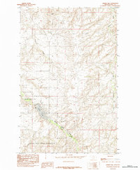
1984 Map of Cement Hill
USGS Topo · Published 1984About this map
Cement Hill rises above a landscape defined by the rugged watercourses of north-central Montana, as documented in this 1984 provisional survey. The southern portion of the map is dominated by the Rocky Boys Indian Reservation and the protected lands of Beaver Creek Park, where the waters of Lower Lake and Beaver Creek are central to the local geography. Industrial infrastructure is evidenced by a Compressor Station located near the center of the sheet, suggesting the regional importance of utility corridors during this era.
Find a feature on this map
9 named features on this map. Tap any name to fly to it.
Don’t see what you’re looking for? This feature index may not catch every label — zoom into the map to look around manually.
Map Details
Editions of this 1984 Cement Hill Map
This is the sole edition of this map. No revisions or reprints were ever made.
Other maps of this area

1904 · Havre
USGS Topo · 1:62,500

1904 · Assinniboine
USGS Topo · 1:62,500

1912 · Thibedeau Lake
USGS Topo · 1:125,000

1953 · Havre
USGS Topo · 1:250,000

1957 · Havre
USGS Topo · 1:250,000

1958 · Havre
USGS Topo · 1:250,000

1959 · Laredo
USGS Topo · 1:62,500

1959 · Shambo
USGS Topo · 1:62,500

1964 · Havre SE
USGS Topo · 1:24,000

1964 · Havre
USGS Topo · 1:24,000