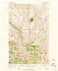
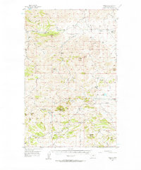
1959 Map of Shambo
USGS Topo · Published 1961About this map
Beaver Creek Park dominates the central corridor of this North Central Montana landscape, marking a protected area of high ridges and deep coulees south of Havre. In the late 1950s, this region functioned as a crossroads for recreation and education, evidenced by the presence of the Shambo Springs (Kiwanis Camp) and several rural educational sites including Eagle Rock Sch and Shambo Sch. The map illustrates a complex terrain where seasonal watercourses like Bullhook Creek and Squaw Coulee carve through the foothills of the Bear Paw Mountains. To the southwest, the boundary of the Rocky Boy Indian Reservation meets the parklands, while prominent summits such as Mount Reynolds and Shambo Mtn provide significant vertical relief. Small-scale extraction and early aviation or communication infrastructure are represented by a Mine, a Prospect, and a Radio Tower near the northern boundary.
Find a feature on this map
35 named features on this map. Tap any name to fly to it.
Don’t see what you’re looking for? This feature index may not catch every label — zoom into the map to look around manually.
Map Details
Editions of this 1959 Shambo Map
3 editions found
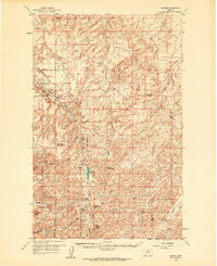
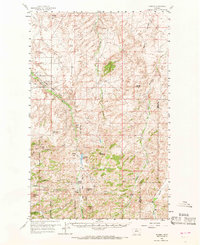
Other maps of this area
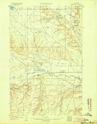
1904 · Yantic
USGS Topo · 1:62,500
1904 · Havre
USGS Topo · 1:62,500
1904 · Assinniboine
USGS Topo · 1:62,500

1912 · Zurich
USGS Topo · 1:125,000

1912 · Thibedeau Lake
USGS Topo · 1:125,000

1953 · Havre
USGS Topo · 1:250,000
1956 · Maddux
USGS Topo · 1:62,500
1956 · Lloyd
USGS Topo · 1:62,500

1957 · Havre
USGS Topo · 1:250,000

1958 · Havre
USGS Topo · 1:250,000