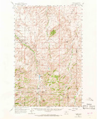
1959 Map of Shambo
USGS Topo · Published 1969About this map
The northern edge of the Rocky Boy Indian Reservation anchors this 1950s survey of the Bearpaw Mountains region in Hill County. The landscape is defined by the winding course of Beaver Creek and the sharp elevation of Mount Reynolds, Shambo Mtn, and Otis Mtn. Small centers of activity appear at Shambo and Shambo Springs (Kiwanis Camp), reflecting the area's history as a remote ranching and seasonal gathering territory. Local education for the dispersed homesteads and reservation residents is recorded at Eagle Rock Sch and Faber Sch.
Find a feature on this map
28 named features on this map. Tap any name to fly to it.
Don’t see what you’re looking for? This feature index may not catch every label — zoom into the map to look around manually.
Map Details
Editions of this 1959 Shambo Map
3 editions found

Other maps of this area

1904 · Yantic
USGS Topo · 1:62,500

1904 · Havre
USGS Topo · 1:62,500

1904 · Assinniboine
USGS Topo · 1:62,500

1912 · Zurich
USGS Topo · 1:125,000

1912 · Thibedeau Lake
USGS Topo · 1:125,000

1953 · Havre
USGS Topo · 1:250,000

1956 · Maddux
USGS Topo · 1:62,500

1956 · Lloyd
USGS Topo · 1:62,500

1957 · Havre
USGS Topo · 1:250,000

1958 · Havre
USGS Topo · 1:250,000