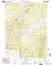
2001 Map of Cement Mountain
USGS Topo · Published 2004About this map
Gunnison National Forest dominates this landscape, where the high country of the Colorado Rockies is defined by deep drainage basins and prominent peaks. The map centers on the winding course of Cement Creek, which flows past the Cement Summer Home Group and the Hot Spring at its base. Elevation changes are extreme, rising from the East River valley floor to the high summits of Cement Mountain and East Cement Mountain. The spatial arrangement of gulches and basins, such as Walrod Gulch and Horse Basin, reveals a complex topography managed for both recreation and timber. Named landmarks like Point Lookout and Strand Hill provide orientation points for this remote mountain terrain during the early 2000s.
Find a feature on this map
31 named features on this map. Tap any name to fly to it.
Don’t see what you’re looking for? This feature index may not catch every label — zoom into the map to look around manually.
Map Details
Editions of this 2001 Cement Mountain Map
This is the sole edition of this map. No revisions or reprints were ever made.
Other maps of this area

1888 · Crested Butte
USGS Topo · 1:62,500

1889 · Crested Butte
USGS Topo · 1:62,500

1893 · Crested Butte
USGS Topo · 1:62,500

1934 · Taylor Park
USGS Topo · 1:62,500

1937 · Taylor Park
USGS Topo · 1:62,500

1941 · Pitkin
USGS Topo · 1:62,500

1945 · Pitkin
USGS Topo · 1:62,500

1956 · Montrose
USGS Topo · 1:250,000

1959 · Montrose
USGS Topo · 1:250,000

1960 · Montrose
USGS Topo · 1:250,000