
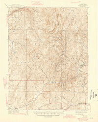
1945 Map of Pitkin
USGS Topo · Published 1945About this map
Gunnison National Forest dominates this high-altitude landscape during a period of active resource extraction and emerging mountain recreation. The map highlights the significant mining infrastructure of the Gold Brick District, specifically locating the Gold Links Mine, Raymond Mine, and Carter Mine along the banks of Gold Creek. These operations, along with the Fairview Mine further north, define the industrial footprint of the era.
Find a feature on this map
68 named features on this map. Tap any name to fly to it.
Don’t see what you’re looking for? This feature index may not catch every label — zoom into the map to look around manually.
Map Details
Editions of this 1945 Pitkin Map
2 editions found
Other maps of this area

1888 · Crested Butte
USGS Topo · 1:62,500

1889 · Crested Butte
USGS Topo · 1:62,500

1893 · Crested Butte
USGS Topo · 1:62,500

1934 · Taylor Park
USGS Topo · 1:62,500

1937 · Taylor Park
USGS Topo · 1:62,500

1940 · Garfield
USGS Topo · 1:62,500

1941 · Pitkin
USGS Topo · 1:62,500

1945 · Garfield
USGS Topo · 1:62,500

1955 · Mount Harvard
USGS Topo · 1:62,500

1956 · Montrose
USGS Topo · 1:250,000