
1941 Map of Pitkin
USGS Topo · Published 1954About this map
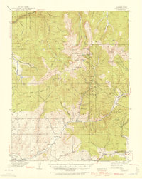
Pitkin and Ohio City anchor this high-elevation survey of Gunnison County, which documents the intensive mining activity that defined the region’s early development. Gold and silver prospects are scattered throughout the peaks, including the Sandy Hook Mine, Gold Links Mine, and Roosevelt Mine. The landscape is a network of steep gulches and high mountain passes, such as Gunsight Pass, which served as critical transit points between remote mining camps. Along the valley floors, small educational and agricultural centers like Sparta and the Sparta Sch provided essential services for the families living near the mines. The drainage of the Taylor River and its numerous tributaries, such as Quartz Creek, illustrate how water access dictated the placement of these early Colorado settlements. This survey captures a transition period where industrial operations like the Camp Bird Mine existed alongside established mountain communities.
Find a feature on this map
113 named features on this map. Tap any name to fly to it.
Don’t see what you’re looking for? This feature index may not catch every label — zoom into the map to look around manually.
Map Details
Editions of this 1941 Pitkin Map
5 editions found
Other maps of this area

1888 · Crested Butte
USGS Topo · 1:62,500

1889 · Crested Butte
USGS Topo · 1:62,500

1893 · Crested Butte
USGS Topo · 1:62,500

1934 · Taylor Park
USGS Topo · 1:62,500

1937 · Taylor Park
USGS Topo · 1:62,500

1940 · Garfield
USGS Topo · 1:62,500

1945 · Pitkin
USGS Topo · 1:62,500

1945 · Garfield
USGS Topo · 1:62,500

1955 · Mount Harvard
USGS Topo · 1:62,500

1956 · Montrose
USGS Topo · 1:250,000