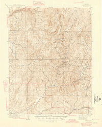
1945 Map of Pitkin
USGS Topo · Published 1945About this map
Pitkin and Ohio City serve as the primary hubs for this mountain landscape, defined by a complex network of high-altitude mining operations and glacial lakes. Deep drainages like Quartz Creek and Gold Creek are lined with evidence of the area's industrial past, featuring notable sites such as the Gold Links Mine, Raymond Mine, and Carter Mine. These mining claims are etched into the steep terrain surrounding peaks like Fairview Mtn and Fossil Mtn.
Find a feature on this map
51 named features on this map. Tap any name to fly to it.
Don’t see what you’re looking for? This feature index may not catch every label — zoom into the map to look around manually.
Map Details
Editions of this 1945 Pitkin Map
2 editions found
Other maps of this area

1888 · Crested Butte
USGS Topo · 1:62,500

1889 · Crested Butte
USGS Topo · 1:62,500

1893 · Crested Butte
USGS Topo · 1:62,500

1934 · Taylor Park
USGS Topo · 1:62,500

1937 · Taylor Park
USGS Topo · 1:62,500

1940 · Garfield
USGS Topo · 1:62,500

1941 · Pitkin
USGS Topo · 1:62,500

1945 · Pitkin
USGS Topo · 1:62,500

1945 · Garfield
USGS Topo · 1:62,500

1955 · Mount Harvard
USGS Topo · 1:62,500