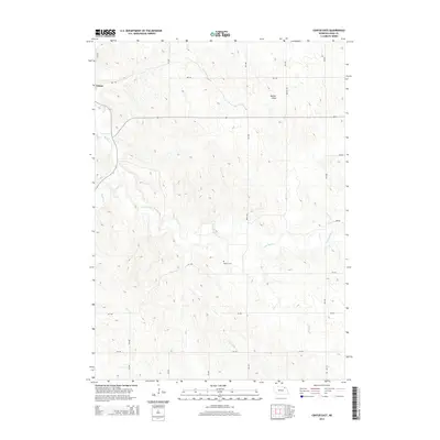
2014 Map of Center East
USGS Topo · Published 2014About this map
Center sits on the western edge of this Knox County landscape, where the plains are deeply etched by the drainage of Bazile Cr and its tributaries. This 2014 survey captures a rural Nebraska terrain defined by a rigid section-line road network, including routes like 882 RD and 537 Ave, which negotiate the undulating landforms near Walker Draw. The map is particularly useful for local historians and genealogists, as it identifies the secluded Kemme Cem situated between the winding path of Little Bazile Cr and the upland reaches of the county road system. The contrast between the strictly surveyed grid of the American West and the irregular, natural courses of the creek beds illustrates the ongoing relationship between agricultural land use and the region's topography.
Find a feature on this map
20 named features on this map. Tap any name to fly to it.
Don’t see what you’re looking for? This feature index may not catch every label — zoom into the map to look around manually.
Map Details
Editions of this 2014 Center East Map
This is the sole edition of this map. No revisions or reprints were ever made.
Other maps of this area

1955 · Sioux City
USGS Topo · 1:250,000

1958 · Sioux City
USGS Topo · 1:250,000

1959 · Sioux City
USGS Topo · 1:250,000

1974 · Sparta
USGS Topo · 1:24,000

1974 · Lindy
USGS Topo · 1:24,000

1974 · Midland
USGS Topo · 1:24,000
1974 · Center West
USGS Topo · 1:24,000
1974 · Creighton
USGS Topo · 1:24,000

1974 · Bloomfield
USGS Topo · 1:24,000
1974 · Plainview NE
USGS Topo · 1:24,000