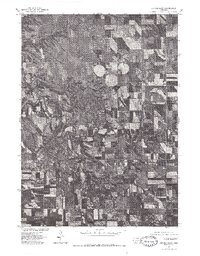
1977 Map of Center East
USGS Topo · Published 1979About this map
Center, the county seat of Knox County, sits in the northwestern corner of this 1977 orthophoto study, providing a clear visual record of the Nebraska landscape just before the turn of the decade. Produced in cooperation with the Bureau of Indian Affairs, this map uses aerial photography to detail the intricate drainage patterns of Brazile Creek as it winds through the agricultural patchwork. The high-altitude imagery distinguishes between the traditional rectangular field plots and the distinct circular patterns of center-pivot irrigation, reflecting a period of technological transition in Great Plains farming. This visual survey is particularly valuable for researchers tracing land-use history and the physical footprint of the small settlement during the late 1970s.
Find a feature on this map
3 named features on this map. Tap any name to fly to it.
Don’t see what you’re looking for? This feature index may not catch every label — zoom into the map to look around manually.
Map Details
Editions of this 1977 Center East Map
This is the sole edition of this map. No revisions or reprints were ever made.
Other maps of this area

1955 · Sioux City
USGS Topo · 1:250,000

1958 · Sioux City
USGS Topo · 1:250,000

1959 · Sioux City
USGS Topo · 1:250,000

1974 · Sparta
USGS Topo · 1:24,000

1974 · Lindy
USGS Topo · 1:24,000

1974 · Midland
USGS Topo · 1:24,000
1974 · Center West
USGS Topo · 1:24,000
1974 · Creighton
USGS Topo · 1:24,000

1974 · Bloomfield
USGS Topo · 1:24,000
1974 · Plainview NE
USGS Topo · 1:24,000