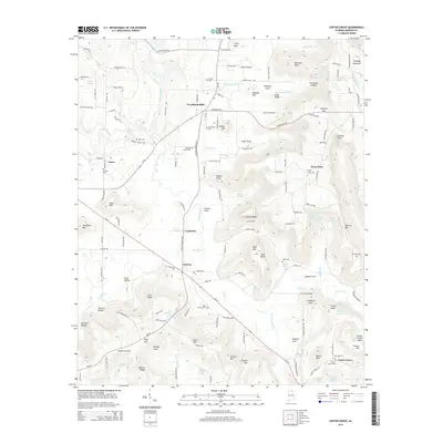
2014 Map of Center Grove
USGS Topo · Published 2014About this map
Woodland Mills and Lynntown anchor the central corridor of this Morgan County landscape, where the terrain rises sharply from the basin of Cotaco Creek toward the high ridges of Brindley Mountain. The settlement pattern reflects a deeply rooted rural community, with small clusters of homes and family farms connected by routes like Al-67 and Union Hill RD. Local history is preserved in numerous burial grounds, including the Antioch Cem and the remote Morrow Cem on the eastern slopes.
Find a feature on this map
158 named features on this map. Tap any name to fly to it.
Don’t see what you’re looking for? This feature index may not catch every label — zoom into the map to look around manually.
Map Details
Editions of this 2014 Center Grove Map
This is the sole edition of this map. No revisions or reprints were ever made.
Other maps of this area

1888 · Cullman
USGS Topo · 1:125,000

1888 · Huntsville
USGS Topo · 1:125,000

1892 · Cullman
USGS Topo · 1:125,000

1892 · Huntsville
USGS Topo · 1:125,000
1936 · Triana
USGS Topo · 1:24,000
1936 · Hulaco
USGS Topo · 1:24,000
1936 · Eva
USGS Topo · 1:24,000
1936 · Somerville
USGS Topo · 1:24,000
1936 · Lawrence Cove
USGS Topo · 1:24,000
1936 · Center Grove
USGS Topo · 1:24,000