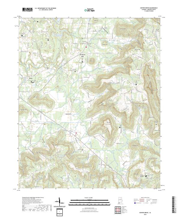
2024 Map of Center Grove
USGS Topo · Published 2024About this map
Brindley Mountain and Georgia Mtn dominate the northern landscape of this Morgan County map, where steep-walled hollows and ridges give way to scattered upland settlements. The community of Woodland Mills sits centrally near Potato Hill, while the namesake Center Grove is located to the southeast, flanked by the Center Grove Cem North and Center Grove Cem South. The terrain is deeply carved by water, with Cotaco Creek and its many tributaries, such as Guyer Branch and Six Mile Creek, defining the local geography.
Find a feature on this map
167 named features on this map. Tap any name to fly to it.
Don’t see what you’re looking for? This feature index may not catch every label — zoom into the map to look around manually.
Map Details
Editions of this 2024 Center Grove Map
This is the sole edition of this map. No revisions or reprints were ever made.
Other maps of this area

1888 · Cullman
USGS Topo · 1:125,000

1888 · Huntsville
USGS Topo · 1:125,000

1892 · Cullman
USGS Topo · 1:125,000

1892 · Huntsville
USGS Topo · 1:125,000

1936 · Triana
USGS Topo · 1:24,000

1936 · Hulaco
USGS Topo · 1:24,000

1936 · Eva
USGS Topo · 1:24,000

1936 · Somerville
USGS Topo · 1:24,000

1936 · Lawrence Cove
USGS Topo · 1:24,000

1936 · Center Grove
USGS Topo · 1:24,000