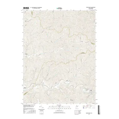
2016 Map of Center Point
USGS Topo · Published 2016About this map
McElroy Creek winds through the southern reaches of this landscape, anchoring the historic community of Center Point. A notable landmark here is the Center Point Covered Bridge, a structural focal point near the intersection of Pike Fork and Talkington Fork. The terrain is characterized by a dense network of drainages and ridges, including Braden Hill and Nurses Hollow, which have historically dictated the placement of small settlements and transportation routes.
Find a feature on this map
76 named features on this map. Tap any name to fly to it.
Don’t see what you’re looking for? This feature index may not catch every label — zoom into the map to look around manually.
Map Details
Editions of this 2016 Center Point Map
This is the sole edition of this map. No revisions or reprints were ever made.
Other maps of this area

1903 · Littleton
USGS Topo · 1:62,500

1905 · Centerpoint
USGS Topo · 1:62,500

1905 · West Union
USGS Topo · 1:62,500

1905 · Littleton
USGS Topo · 1:62,500

1906 · New Martinsville
USGS Topo · 1:62,500

1924 · New Martinsville
USGS Topo · 1:62,500

1924 · Centerpoint
USGS Topo · 1:62,500

1924 · Littleton
USGS Topo · 1:62,500

1924 · West Union
USGS Topo · 1:62,500

1925 · Centerpoint
USGS Topo · 1:62,500