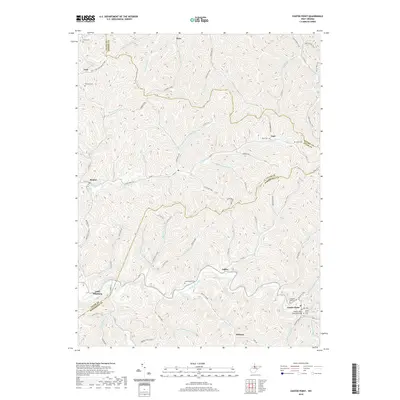
2019 Map of Center Point
USGS Topo · Published 2019About this map
McElroy Creek winds through the heart of this Appalachian landscape, serving as a central corridor for the settlements of Ashley and Center Point. This 2019 survey captures the convergence of Tyler, Wetzel, and Doddridge Counties, a region characterized by deep hollows like Nurses Hollow and prominent ridges such as Hart Ridge. The local geography is marked by numerous family and community landmarks, including the Center Point Covered Bridge, which remains a significant architectural fixture near the Center Point Cem. Smaller hamlets like Little Pittsburg and Braden are tucked along secondary roads and creek forks, illustrating a traditional West Virginia settlement pattern. Genealogists will find a high density of rural burial grounds, ranging from the Parks Cem in the north to the Pleasant Baptist Cem in the southeast, documenting the long-standing family ties to this terrain.
Find a feature on this map
82 named features on this map. Tap any name to fly to it.
Don’t see what you’re looking for? This feature index may not catch every label — zoom into the map to look around manually.
Map Details
Editions of this 2019 Center Point Map
This is the sole edition of this map. No revisions or reprints were ever made.
Other maps of this area

1903 · Littleton
USGS Topo · 1:62,500

1905 · Centerpoint
USGS Topo · 1:62,500

1905 · West Union
USGS Topo · 1:62,500

1905 · Littleton
USGS Topo · 1:62,500

1906 · New Martinsville
USGS Topo · 1:62,500

1924 · New Martinsville
USGS Topo · 1:62,500

1924 · Centerpoint
USGS Topo · 1:62,500

1924 · Littleton
USGS Topo · 1:62,500

1924 · West Union
USGS Topo · 1:62,500

1925 · Centerpoint
USGS Topo · 1:62,500