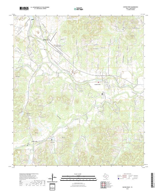
2022 Map of Center Point
USGS Topo · Published 2022About this map
The Guadalupe River and Verde Cr shape the landscape of this Kerr County region, where the town of Center Point serves as a central hub near the river's path. Further west, the terrain rises into the notable heights of Lookout Mtn and Mt Verde, while the settlement of Camp Verde sits in the valley below. This modern topographic record captures the transition from the organized aviation facilities at Kerrville Municipal Airport/Louis Schreiner Field to the rural expanses of Dry Hollow and Nowlin Hollow.
Find a feature on this map
128 named features on this map. Tap any name to fly to it.
Don’t see what you’re looking for? This feature index may not catch every label — zoom into the map to look around manually.
Map Details
Editions of this 2022 Center Point Map
This is the sole edition of this map. No revisions or reprints were ever made.
Historical Maps of Kerrville Through Time
3 maps found