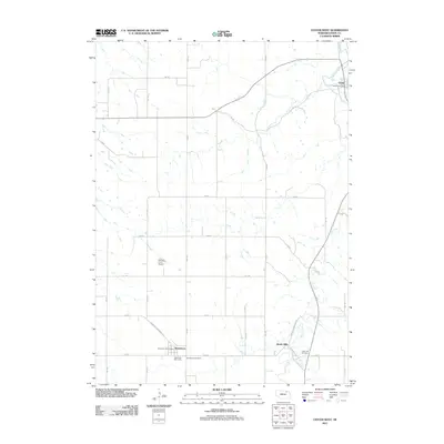
2011 Map of Center West
USGS Topo · Published 2011About this map
Center and Bazile Mills anchor this Knox County landscape, where the agricultural grid meets the winding course of Bazile Creek. The map documents a rural Nebraska community defined by small settlements and established family farms, as seen at the Herberts Farm Airport. Civil infrastructure is concentrated along the section lines and within the small town plots, including the Winnetoon Post Office and the Center Post Office, which serve as vital local hubs. The drainage patterns of Spring Creek and its tributaries reveal the importance of water management in this prairie environment. For those researching local heritage, the inclusion of Winnetoon Cemetery and Cedar Hill Cemetery provides clear geographic markers for ancestral sites, while the Bethesda Mini Camp suggests the area's role in regional community gatherings. The road network, including Winnetoon-Sherman Ave, reflects the organized settlement patterns of the Great Plains.
Find a feature on this map
29 named features on this map. Tap any name to fly to it.
Don’t see what you’re looking for? This feature index may not catch every label — zoom into the map to look around manually.
Map Details
Editions of this 2011 Center West Map
This is the sole edition of this map. No revisions or reprints were ever made.
Other maps of this area

1950 · Verdigre NE
USGS Topo · 1:24,000

1954 · Verdigre
USGS Topo · 1:24,000

1955 · Sioux City
USGS Topo · 1:250,000

1955 · O'Neill
USGS Topo · 1:250,000

1958 · Sioux City
USGS Topo · 1:250,000

1959 · O'Neill
USGS Topo · 1:250,000

1959 · Sioux City
USGS Topo · 1:250,000

1963 · Orchard NE
USGS Topo · 1:24,000

1969 · O'Neill
USGS Topo · 1:250,000

1974 · Sparta
USGS Topo · 1:24,000