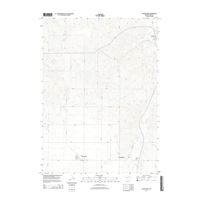
2014 Map of Center West
USGS Topo · Published 2014About this map
Winnetoon and Bazile Mills anchor the southern portion of this Knox County landscape, where the agricultural grid meets the winding course of Bazile Cr. The terrain is defined by the drainage patterns of Spring Cr and several unnamed tributaries, creating a dissected topography that dictates the placement of rural roads like 875 Rd and 529 Ave. Near the village of Winnetoon, the Winnetoon Cem serves as a significant landmark for genealogical research, while the Cedar Hill Cem sits further east near the creek. To the northeast, the small seat of Center is situated near the junction of Santee St and Bazile St. This 2014 survey illustrates the persistence of these small plains communities and their connection to the local watercourses and section-line road network.
Find a feature on this map
28 named features on this map. Tap any name to fly to it.
Don’t see what you’re looking for? This feature index may not catch every label — zoom into the map to look around manually.
Map Details
Editions of this 2014 Center West Map
This is the sole edition of this map. No revisions or reprints were ever made.
Other maps of this area

1950 · Verdigre NE
USGS Topo · 1:24,000

1954 · Verdigre
USGS Topo · 1:24,000

1955 · Sioux City
USGS Topo · 1:250,000

1955 · O'Neill
USGS Topo · 1:250,000

1958 · Sioux City
USGS Topo · 1:250,000

1959 · O'Neill
USGS Topo · 1:250,000

1959 · Sioux City
USGS Topo · 1:250,000

1963 · Orchard NE
USGS Topo · 1:24,000

1969 · O'Neill
USGS Topo · 1:250,000

1974 · Sparta
USGS Topo · 1:24,000