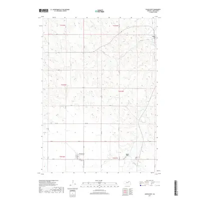
2017 Map of Center West
USGS Topo · Published 2017About this map
Center and Winnetoon anchor this topographic survey of Knox County, showcasing the rural character of northern Nebraska. The landscape is defined by the winding course of Bazile Cr as it moves through the eastern sections, complemented by Spring Cr to the south. Small-town infrastructure is captured in detail, particularly in the village of Bazile Mills, where Bazile Main St serves as a primary corridor. Genealogists will find particular value in the documentation of the Winnetoon Cem and the Cedar Hill Cem, which sit alongside a grid of section roads like 875 Rd and 528 Ave. The map reflects a long-established agricultural pattern, where the township and range system creates a distinct geometric overlay on the natural drainage of the Bazile Creek watershed.
Find a feature on this map
34 named features on this map. Tap any name to fly to it.
Don’t see what you’re looking for? This feature index may not catch every label — zoom into the map to look around manually.
Map Details
Editions of this 2017 Center West Map
This is the sole edition of this map. No revisions or reprints were ever made.
Other maps of this area

1950 · Verdigre NE
USGS Topo · 1:24,000

1954 · Verdigre
USGS Topo · 1:24,000

1955 · Sioux City
USGS Topo · 1:250,000

1955 · O'Neill
USGS Topo · 1:250,000

1958 · Sioux City
USGS Topo · 1:250,000

1959 · O'Neill
USGS Topo · 1:250,000

1959 · Sioux City
USGS Topo · 1:250,000

1963 · Orchard NE
USGS Topo · 1:24,000

1969 · O'Neill
USGS Topo · 1:250,000

1974 · Sparta
USGS Topo · 1:24,000