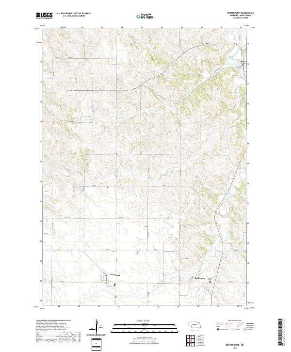
2021 Map of Center West
USGS Topo · Published 2021About this map
Center serves as a focal point in this portion of Knox County, home to the Knox County Courthouse perched near the winding path of Bazile Creek. The landscape is characterized by the agricultural grid of the Great Plains, where section lines dictate the path of rural routes like 881 RD and 875 RD. To the south, the small settlements of Winnetoon and Bazile Mills anchor the local community, with the latter situated near the confluence of Spring Cr and the larger creek system. Genealogists will find point data for Winnetoon Cem and Cedar Hill Cem, reflecting the early 21st-century state of these long-established Nebraska townships. The terrain transition from flat upland fields to the carved valleys of the Bazile Creek drainage reveals the fundamental relationship between the region's water sources and its historic town placements.
Find a feature on this map
26 named features on this map. Tap any name to fly to it.
Don’t see what you’re looking for? This feature index may not catch every label — zoom into the map to look around manually.
Map Details
Editions of this 2021 Center West Map
This is the sole edition of this map. No revisions or reprints were ever made.
Other maps of this area

1950 · Verdigre NE
USGS Topo · 1:24,000

1954 · Verdigre
USGS Topo · 1:24,000

1955 · Sioux City
USGS Topo · 1:250,000

1955 · O'Neill
USGS Topo · 1:250,000

1958 · Sioux City
USGS Topo · 1:250,000

1959 · O'Neill
USGS Topo · 1:250,000

1959 · Sioux City
USGS Topo · 1:250,000

1963 · Orchard NE
USGS Topo · 1:24,000

1969 · O'Neill
USGS Topo · 1:250,000

1974 · Sparta
USGS Topo · 1:24,000