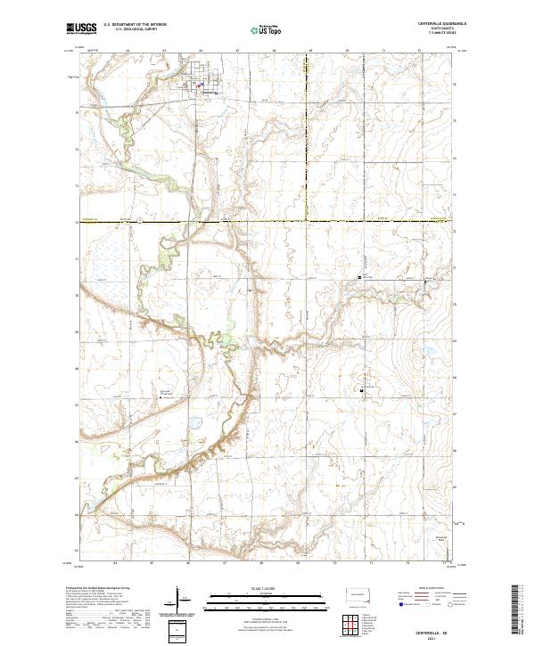
2021 Map of Centerville
USGS Topo · Published 2021About this map
Centerville sits at the northern edge of this Southeastern South Dakota landscape, where the Vermillion River carves a winding path through the prairie. The region is defined by its deep agricultural roots and a meticulously planned grid of rural section roads, including S Dakota Hwy 46 and Oil Rd. This 2021 survey reveals a cultural landscape preserved in its family and community burial grounds, such as Riverside - Barton Cem and Saint Johns Cem, which reflect the early settlement patterns of Turner and Clay counties. Water management is a central theme of the terrain, visible through established channels like Bonine Ditch and Noble Ditch that supplement the natural drainage of Turkey Ridge Creek and Blind Cr. In the far southeast corner, Glenwood Field serves as a modern waypoint in a territory otherwise dominated by long-standing farmsteads and traditional townships.
Find a feature on this map
47 named features on this map. Tap any name to fly to it.
Don’t see what you’re looking for? This feature index may not catch every label — zoom into the map to look around manually.
Map Details
Editions of this 2021 Centerville Map
This is the sole edition of this map. No revisions or reprints were ever made.
Other maps of this area

1897 · Canton
USGS Topo · 1:125,000

1898 · Parker
USGS Topo · 1:125,000

1898 · Elk Point
USGS Topo · 1:125,000

1900 · Canton
USGS Topo · 1:125,000

1901 · Elk Point
USGS Topo · 1:125,000

1907 · Elk Point
USGS Topo · 1:125,000

1955 · Sioux City
USGS Topo · 1:250,000

1955 · Sioux Falls
USGS Topo · 1:250,000

1958 · Sioux City
USGS Topo · 1:250,000

1958 · Sioux Falls
USGS Topo · 1:250,000
Featured Places
- Centerville, SD
- Brooklyn Township, SD
- Glenwood Township, SD
- Centerville Township, SD
- Riverside Township, SD