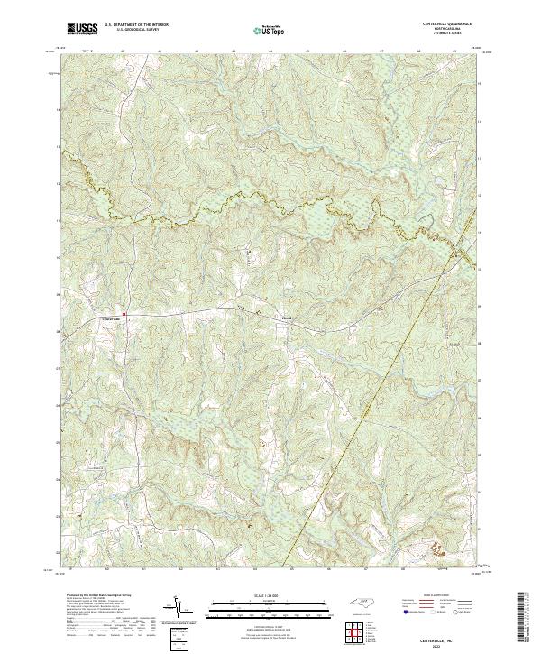
2022 Map of Centerville
USGS Topo · Published 2022About this map
The community of Centerville and the settlement of Wood anchor this survey of the undulating landscape where the coastal plain meets the Piedmont. The terrain is defined by a complex network of wetlands and drainages, most notably White Oak Swamp and the meandering Shocco Cr, which serves as a boundary between Franklin and Warren counties. These watercourses were historically central to local movement and commerce, as evidenced by the namesake Collins Mill Rd. Cultural and social landmarks are represented through road names that indicate community hubs, such as Red Bud Church Rd and Mount Hebron Rd. The map reveals a rural economy shaped by proximity to water and woods, with numerous family-named landmarks like Freeman Cabin Rd and Pullen Pasture Rd providing valuable clues for local genealogy and land-use history.
Find a feature on this map
46 named features on this map. Tap any name to fly to it.
Don’t see what you’re looking for? This feature index may not catch every label — zoom into the map to look around manually.
Map Details
Editions of this 2022 Centerville Map
This is the sole edition of this map. No revisions or reprints were ever made.
Other maps of this area

1953 · Norfolk
USGS Topo · 1:250,000

1953 · Greensboro
USGS Topo · 1:250,000

1954 · Greensboro
USGS Topo · 1:250,000

1962 · Greensboro
USGS Topo · 1:250,000

1963 · Red Oak
USGS Topo · 1:24,000

1963 · Essex
USGS Topo · 1:24,000

1966 · Greensboro
USGS Topo · 1:250,000

1971 · Inez
USGS Topo · 1:24,000

1971 · Afton
USGS Topo · 1:24,000

1973 · Hollister
USGS Topo · 1:24,000