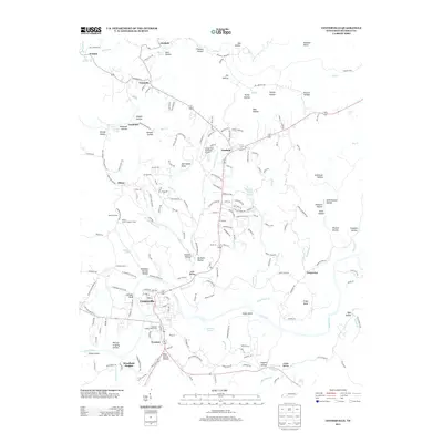
2013 Map of Centerville
USGS Topo · Published 2013About this map
The Duck River winds through the heart of this Hickman County landscape, anchoring the settlement of Centerville and its surrounding communities. The town layout is defined by the proximity of the water and the Hickman County Fairgrounds, while the surrounding terrain is deeply etched by family-named landmarks and historical industrial markers. To the north, the confluence of geography and rail history is visible at Goodrich and Nunnelly, where the land rises into prominent ridges like Harrington Ridge. The map documents a landscape where traditional river-valley settlements meet modern infrastructure, such as the Centerville Municipal Airport. Notable topographic features including Grinder Bluff and Eason Bend illustrate the meandering path of the river, while smaller settlements like Twomey and Woodland Heights reflect the area’s residential growth south of the main township.
Find a feature on this map
205 named features on this map. Tap any name to fly to it.
Don’t see what you’re looking for? This feature index may not catch every label — zoom into the map to look around manually.
Map Details
Editions of this 2013 Centerville Map
This is the sole edition of this map. No revisions or reprints were ever made.
Other maps of this area

1901 · Colombia
USGS Topo · 1:125,000

1936 · Beaverdam Springs
USGS Topo · 1:24,000

1936 · Nunnelly
USGS Topo · 1:24,000

1936 · Whitfield
USGS Topo · 1:24,000

1936 · Sunrise
USGS Topo · 1:24,000

1936 · Littlelot
USGS Topo · 1:24,000

1936 · Texas Hollow
USGS Topo · 1:24,000

1936 · Spot
USGS Topo · 1:24,000

1936 · Greenfield Bend
USGS Topo · 1:24,000

1936 · Lyles
USGS Topo · 1:24,000