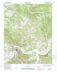
1952 Map of Centerville
USGS Topo · Published 1988About this map
The Centerville area is defined by the winding course of the Duck River as it carves through the undulating landscape of Hickman County. This 1952 study, updated in the late 1980s, highlights a region where the industrial extraction of the past meets mid-century infrastructure. Numerous Strip mines and the Nunnelly Mines (Abandoned) testify to the area's history of iron and mineral work, while the Stillman Spoke Mill near Graham points to traditional timber processing.
Find a feature on this map
79 named features on this map. Tap any name to fly to it.
Don’t see what you’re looking for? This feature index may not catch every label — zoom into the map to look around manually.
Map Details
Editions of this 1952 Centerville Map
This is the sole edition of this map. No revisions or reprints were ever made.
Other maps of this area

1901 · Colombia
USGS Topo · 1:125,000

1936 · Beaverdam Springs
USGS Topo · 1:24,000

1936 · Nunnelly
USGS Topo · 1:24,000

1936 · Whitfield
USGS Topo · 1:24,000

1936 · Sunrise
USGS Topo · 1:24,000

1936 · Littlelot
USGS Topo · 1:24,000

1936 · Texas Hollow
USGS Topo · 1:24,000

1936 · Spot
USGS Topo · 1:24,000

1936 · Greenfield Bend
USGS Topo · 1:24,000

1936 · Lyles
USGS Topo · 1:24,000