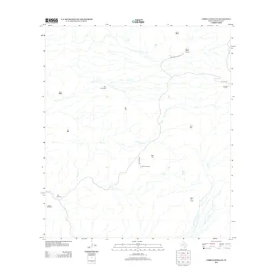
2012 Map of Cerro Castellan
USGS Topo · Published 2012About this map
Cerro Castellan rises as a prominent landmark in this desert landscape, where water sources like Tule Spring and Burro Spring have long served as vital points in an arid environment. The map details a network of drainage systems, including Blue Cr and Smoky Cr, which carve through the terrain near the distinctive twin heights of the Mule Ear Peaks. These geologic features, alongside the volcanic formations of Tuff Canyon and the weathered stone of The Chimneys, define a region shaped by erosion and elevation extremes.
Find a feature on this map
22 named features on this map. Tap any name to fly to it.
Don’t see what you’re looking for? This feature index may not catch every label — zoom into the map to look around manually.
Map Details
Editions of this 2012 Cerro Castellan Map
This is the sole edition of this map. No revisions or reprints were ever made.
Other maps of this area

1903 · Chisos Mountains
USGS Topo · 1:125,000

1903 · Terlingua
USGS Topo · 1:125,000

1904 · Terlingua
USGS Topo · 1:125,000

1905 · Chisos Mountains
USGS Topo · 1:125,000

1959 · Emory Peak
USGS Topo · 1:250,000

1965 · Emory Peak
USGS Topo · 1:250,000

1971 · Terlingua
USGS Topo · 1:24,000

1971 · Cerro Castellan
USGS Topo · 1:24,000
1971 · Reed Camp
USGS Topo · 1:24,000
1971 · Tule Mountain
USGS Topo · 1:24,000