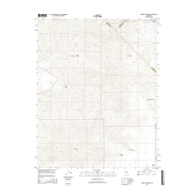
2015 Map of Cerro Colorado
USGS Topo · Published 2015About this map
Cerro Colorado rises as a prominent landmark within the Diablo Range on this modern survey of the California Coast Ranges. The topography is defined by sharp elevation changes and deeply cut drainages such as Las Aguilas Canyon and the winding course of Mercey Cr. The landscape transitions from the broad Little Panoche Valley in the northeast toward more complex interior terrain marked by Glaucophane Ridge and Slacks Valley. Evidence of the area's resource history is noted by a Mine located in the northern reaches, while the modern infrastructure is largely limited to Little Panoche Rd following the eastern boundary. This map records the intersection of Fresno, Merced, and San Benito counties, providing a clear look at the remote canyon systems including Vasquez Cr and Las Aguilas Cr as they appeared in 2015.
Find a feature on this map
21 named features on this map. Tap any name to fly to it.
Don’t see what you’re looking for? This feature index may not catch every label — zoom into the map to look around manually.
Map Details
Editions of this 2015 Cerro Colorado Map
This is the sole edition of this map. No revisions or reprints were ever made.
Other maps of this area

1913 · Panoche
USGS Topo · 1:125,000

1919 · San Benito
USGS Topo · 1:62,500

1921 · Laguna Seca Ranch
USGS Topo · 1:31,680

1922 · Quien Sabe
USGS Topo · 1:62,500

1923 · Laguna Seca Ranch
USGS Topo · 1:31,680

1931 · San Benito
USGS Topo · 1:62,500

1940 · Quien Sabe
USGS Topo · 1:62,500

1940 · San Benito
USGS Topo · 1:62,500

1943 · Ortigalita Peak
USGS Topo · 1:62,500

1944 · Panoche Valley
USGS Topo · 1:62,500