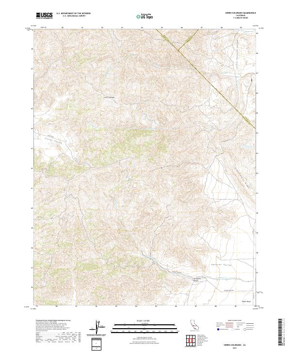
2021 Map of Cerro Colorado
USGS Topo · Published 2021About this map
Cerro Colorado rises as a prominent landmark in this modern topographic survey of the Diablo Range, where the borders of San Benito, Fresno, and Merced counties converge. The landscape is defined by its deep canyons and expansive basins, notably the Panoche Valley and Little Panoche Valley, which reflect the tectonic and alluvial character of this part of California. A network of ephemeral waterways, including Mercey Cr and Vasquez Cr, drains the high ridges. The presence of Glaucophane Ridge highlights the unique geologic composition of the region, while Las Aguilas Canyon provides a sharp descent toward the southern valley floor. Sparse transit corridors like Panoche Rd and Vasquez Creek Rd follow the natural contours of the land, connecting these remote ranching and watershed areas.
Find a feature on this map
25 named features on this map. Tap any name to fly to it.
Don’t see what you’re looking for? This feature index may not catch every label — zoom into the map to look around manually.
Map Details
Editions of this 2021 Cerro Colorado Map
This is the sole edition of this map. No revisions or reprints were ever made.
Other maps of this area

1913 · Panoche
USGS Topo · 1:125,000

1919 · San Benito
USGS Topo · 1:62,500

1921 · Laguna Seca Ranch
USGS Topo · 1:31,680

1922 · Quien Sabe
USGS Topo · 1:62,500

1923 · Laguna Seca Ranch
USGS Topo · 1:31,680

1931 · San Benito
USGS Topo · 1:62,500

1940 · Quien Sabe
USGS Topo · 1:62,500

1940 · San Benito
USGS Topo · 1:62,500

1943 · Ortigalita Peak
USGS Topo · 1:62,500

1944 · Panoche Valley
USGS Topo · 1:62,500