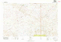
1977 Map of Chaco Mesa
USGS Topo · Published 1978About this map
The Continental Divide winds through this high-desert landscape, separating the drainage of Chaco Wash from the eastern mesas. This late-1970s survey documents a region defined by archaeological significance and remote trading centers, including the eastern portions of Chaco Canyon National Monument. The settlement pattern relies heavily on traditional commerce points like the Star Lake Trading Post, Prairie-Dog Trading Post, and Johnson Trading Post, which served as vital hubs for the local Navajo community. To the south and east, the terrain rises into the prominent Chaco Mesa and San Luis Mesa, punctuated by isolated settlements such as Hospah and the Torreon Navajo Mission. The map also captures numerous natural catchments and ephemeral water sources like Laguna Trujillo and Seven Lakes, illustrating the hydrological challenges of life in the San Juan Basin.
Find a feature on this map
33 named features on this map. Tap any name to fly to it.
Don’t see what you’re looking for? This feature index may not catch every label — zoom into the map to look around manually.
Map Details
Editions of this 1977 Chaco Mesa Map
2 editions found
Other maps of this area

1883 · Mt. Taylor
USGS Topo · 1:250,000

1886 · Wingate
USGS Topo · 1:250,000

1886 · Mt. Taylor
USGS Topo · 1:250,000

1888 · Bernalillo
USGS Topo · 1:125,000

1889 · Albuquerque
USGS Topo · 1:125,000

1889 · Largo
USGS Topo · 1:250,000

1889 · Chaco
USGS Topo · 1:250,000

1890 · Jemes
USGS Topo · 1:125,000

1892 · Jemes
USGS Topo · 1:125,000

1892 · Wingate
USGS Topo · 1:250,000