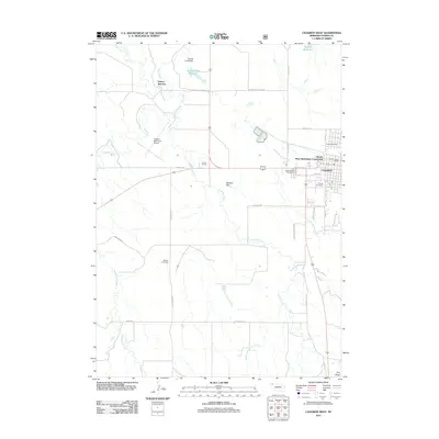
2011 Map of Chadron West
USGS Topo · Published 2011About this map
Dakota Junction sits at the northern edge of this Nebraska landscape, where the White River and several creek systems converge. This 2011 survey illustrates the western expansion of Chadron, documenting the layout of residential areas and essential civic infrastructure including the Chadron Post Office and Chadron Municipal Airport. The map is particularly useful for genealogists, as it identifies three distinct burial grounds: Greenwood Cemetery, Calvary Cemetery, and the more rural Shisler Cemetery located south of the main settlement.
Find a feature on this map
38 named features on this map. Tap any name to fly to it.
Don’t see what you’re looking for? This feature index may not catch every label — zoom into the map to look around manually.
Map Details
Editions of this 2011 Chadron West Map
This is the sole edition of this map. No revisions or reprints were ever made.
Other maps of this area

1955 · Alliance
USGS Topo · 1:250,000

1957 · Alliance
USGS Topo · 1:250,000

1958 · Alliance
USGS Topo · 1:250,000
1970 · Bohemian Creek
USGS Topo · 1:24,000

1970 · Chadron 3 NW
USGS Topo · 1:24,000
1970 · Chadron East
USGS Topo · 1:24,000
1970 · Isinglass Buttes
USGS Topo · 1:24,000
1980 · Coffee Mill Butte
USGS Topo · 1:24,000

1980 · Wayside
USGS Topo · 1:24,000
1980 · Trunk Butte
USGS Topo · 1:24,000