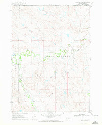
1970 Map of Isinglass Buttes
USGS Topo · Published 1972About this map
The Isinglass Buttes rise as a prominent landform south of the White River in this western Nebraska landscape. Surveyed in the early 1970s, the terrain is defined by the winding course of the river and its tributaries, including Bordeaux Creek, Alkali Creek, and Madden Creek. The division between West Chadron and East Chadron reflects the local administrative organization of Dawes County during this era. While largely an open landscape, several Gravel Pits indicate localized extraction activity near the watercourses. The map also documents precise elevation markers such as BM 3217 and BM 3133, which were used to establish the topography of this high plains region. Aerial photography from 1966 was utilized to trace the network of field lines and fences that crisscross the area between the buttes and the river bottomlands.
Find a feature on this map
15 named features on this map. Tap any name to fly to it.
Don’t see what you’re looking for? This feature index may not catch every label — zoom into the map to look around manually.
Map Details
Editions of this 1970 Isinglass Buttes Map
This is the sole edition of this map. No revisions or reprints were ever made.
Other maps of this area

1896 · Oelrichs
USGS Topo · 1:125,000

1900 · Oelrichs
USGS Topo · 1:125,000

1955 · Hot Springs
USGS Topo · 1:250,000

1955 · Alliance
USGS Topo · 1:250,000

1957 · Alliance
USGS Topo · 1:250,000

1958 · Alliance
USGS Topo · 1:250,000

1967 · Slim Butte SW
USGS Topo · 1:24,000

1967 · Slim Butte
USGS Topo · 1:24,000

1969 · Chadron NE
USGS Topo · 1:24,000

1969 · Bordeaux
USGS Topo · 1:24,000