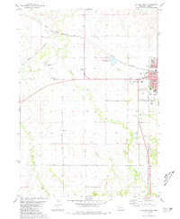
1980 Map of Chadron West
USGS Topo · Published 1981About this map
Chadron serves as the focal point of this 1980 survey, where the convergence of the Chicago and North Western railroad and the White River defines the local geography. The map captures the town's role as a regional hub, featuring the campus of Chadron State College and the local Courthouse. Outside the main settlement, the landscape transitions from the riparian corridors of Lone Tree Creek and Chadron Creek to the protected land of the Nebraska National Forest.
Find a feature on this map
29 named features on this map. Tap any name to fly to it.
Don’t see what you’re looking for? This feature index may not catch every label — zoom into the map to look around manually.
Map Details
Editions of this 1980 Chadron West Map
2 editions found
Other maps of this area

1955 · Alliance
USGS Topo · 1:250,000

1957 · Alliance
USGS Topo · 1:250,000

1958 · Alliance
USGS Topo · 1:250,000
1970 · Bohemian Creek
USGS Topo · 1:24,000

1970 · Chadron 3 NW
USGS Topo · 1:24,000
1970 · Chadron East
USGS Topo · 1:24,000
1970 · Isinglass Buttes
USGS Topo · 1:24,000
1980 · Coffee Mill Butte
USGS Topo · 1:24,000

1980 · Wayside
USGS Topo · 1:24,000
1980 · Trunk Butte
USGS Topo · 1:24,000