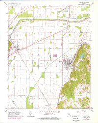
1963 Map of Chaffee
USGS Topo · Published 1978About this map
The Headwater Diversion Channel cuts a sharp east-west line across this landscape, illustrating the massive hydrological engineering required to manage the wetlands of the northern Mississippi Embayment. This 1963 survey (with 1970s revisions) centers on the rail-centric community of Chaffee, where the St Louis-San Francisco and St Louis Southwestern lines intersect. The industrial character of the era is evident in the numerous quarries and gravel pits near Rockview, while leisure spots like Lake Tywappity and a Drive-in Theater near Blomeyer mark the post-war social landscape. Significant elevation changes are found to the south at Cox Hill and Bell Hill, where the Bell Hill Cem overlooks the Old Caney Basin, providing a stark contrast to the flat, channelized plains of the Hubble Creek valley to the north.
Find a feature on this map
40 named features on this map. Tap any name to fly to it.
Don’t see what you’re looking for? This feature index may not catch every label — zoom into the map to look around manually.
Map Details
Editions of this 1963 Chaffee Map
2 editions found
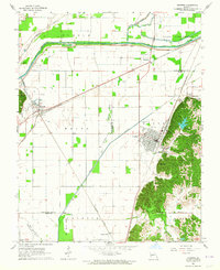
Other maps of this area

1922 · Cape Girardeau
USGS Topo · 1:62,500

1924 · Cape Girardeau
USGS Topo · 1:62,500

1933 · Marble Hill
USGS Topo · 1:62,500

1934 · Morley
USGS Topo · 1:62,500

1934 · Advance
USGS Topo · 1:62,500

1937 · Marble Hill
USGS Topo · 1:62,500

1939 · Morley
USGS Topo · 1:62,500

1939 · Advance
USGS Topo · 1:62,500

1949 · Paducah
USGS Topo · 1:250,000

1950 · Paducah
USGS Topo · 1:250,000