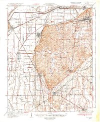
1934 Map of Morley
USGS Topo · Published 1934About this map
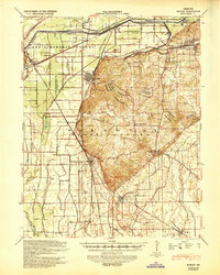
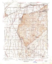
The Headwater Diversion Channel cuts a massive engineered path across the landscape, marking a period of significant drainage transformation in the Mississippi River basin. This survey shows the agricultural transition of the Old Caney Basin and the surrounding lowland prairies, where an intricate network of ditches like Ditch No 17 and Ditch No 19 reclaimed swampy terrain for cultivation. The region is defined by a dense rail infrastructure, with the Missouri Pacific RR and the St Louis San Francisco RR intersecting at key shipping points and junctions.
Find a feature on this map
65 named features on this map. Tap any name to fly to it.
Don’t see what you’re looking for? This feature index may not catch every label — zoom into the map to look around manually.
Map Details
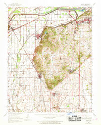
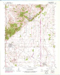
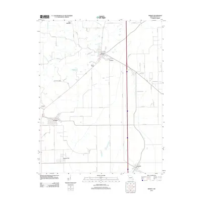
Editions of this 1934 Morley Map
3 editions found
Historical Maps of Cape Girardeau Through Time
8 maps found