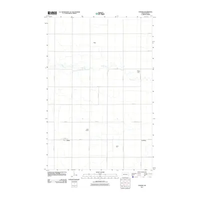
2011 Map of Chaffee
USGS Topo · Published 2011About this map
Buffalo Creek winds through this agricultural landscape, carving a meandering path across the section lines of Everest Township. The small settlement of Chaffee serves as a primary hub, organized around Main St and 2nd St N in the southwestern portion of the quadrangle. This area of Cass County is defined by a rigid grid of rural roads, such as 150th Ave SE and 44th St SE, which connect dispersed homesteads and local landmarks. To the north and east, the communities of Myra and Lynchburg anchor the surrounding farmland. The presence of the United Brethren Cemetery provides a specific point of interest for genealogists tracing early families in the region. Private aviation is also represented on the landscape with the Dittmer Landing Strip and Poulson Field, reflecting the vast distances and specialized needs of North Dakota prairie life.
Find a feature on this map
24 named features on this map. Tap any name to fly to it.
Don’t see what you’re looking for? This feature index may not catch every label — zoom into the map to look around manually.
Map Details
Editions of this 2011 Chaffee Map
This is the sole edition of this map. No revisions or reprints were ever made.
Other maps of this area

1895 · Casselton
USGS Topo · 1:125,000

1897 · Casselton
USGS Topo · 1:125,000

1953 · Fargo
USGS Topo · 1:250,000

1956 · Fargo
USGS Topo · 1:250,000

1959 · Leonard
USGS Topo · 1:24,000

1961 · Durbin
USGS Topo · 1:24,000

1961 · Casselton
USGS Topo · 1:24,000

1961 · Sheldon NW
USGS Topo · 1:24,000
1961 · Sheldon NE
USGS Topo · 1:24,000
1967 · Wheatland
USGS Topo · 1:24,000