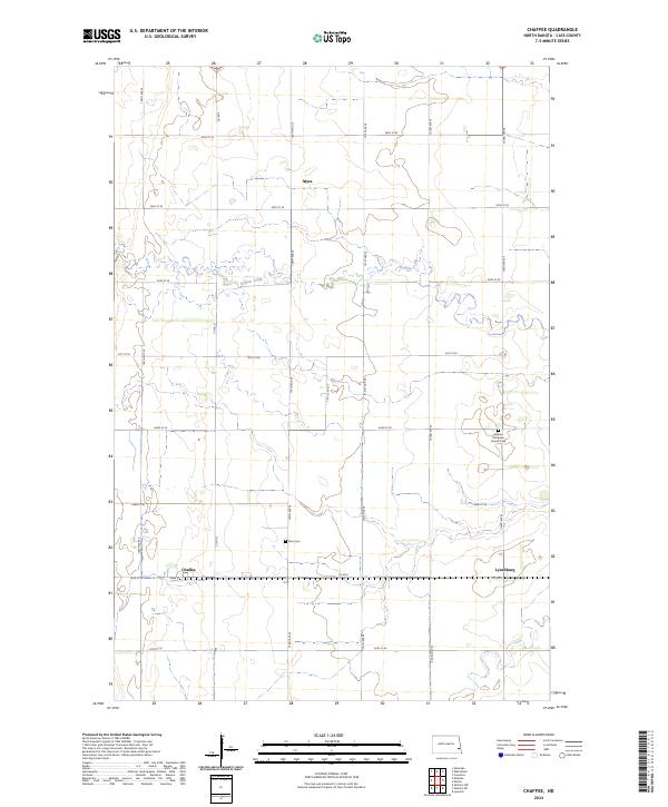
2024 Map of Chaffee
USGS Topo · Published 2024About this map
Chaffee and Lynchburg anchor the southern reaches of this agricultural landscape in Cass County, where the grid of sections is occasionally interrupted by the winding path of Buffalo Creek. This waterway meanders across the northern half of the territory, passing near the small settlement of Myra. The map documents a well-established rural infrastructure defined by a dense network of gravel and section-line roads such as Co Rd 5 and Co Rd 6. For those tracing local history or family ties, the preservation of sites like Goshen Moravian Church Cem and Zion Cem provides specific points of reference within the wide-open prairie. The settlement pattern remains centered on these small clusters, reflecting the enduring rail and road connectivity of the Red River Valley region.
Find a feature on this map
28 named features on this map. Tap any name to fly to it.
Don’t see what you’re looking for? This feature index may not catch every label — zoom into the map to look around manually.
Map Details
Editions of this 2024 Chaffee Map
This is the sole edition of this map. No revisions or reprints were ever made.
Other maps of this area

1895 · Casselton
USGS Topo · 1:125,000

1897 · Casselton
USGS Topo · 1:125,000

1953 · Fargo
USGS Topo · 1:250,000

1956 · Fargo
USGS Topo · 1:250,000

1959 · Leonard
USGS Topo · 1:24,000

1961 · Durbin
USGS Topo · 1:24,000

1961 · Casselton
USGS Topo · 1:24,000

1961 · Sheldon NW
USGS Topo · 1:24,000
1961 · Sheldon NE
USGS Topo · 1:24,000
1967 · Wheatland
USGS Topo · 1:24,000