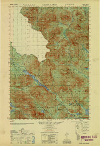
1951 Map of Chain Lakes
USGS Topo · Published 1951About this map
The international border between the United States and Canada defines the northwest corner of this Franklin County wilderness, where the historic Arnold Trail follows the corridor of the Chain of Ponds Lakes. This 1951 compilation of earlier surveys illustrates a remote landscape dominated by timber management and high peaks like Caribou Mountain and Snow Mtn, the latter topped with a Fire Tower.
Find a feature on this map
72 named features on this map. Tap any name to fly to it.
Don’t see what you’re looking for? This feature index may not catch every label — zoom into the map to look around manually.
Map Details
Editions of this 1951 Chain Lakes Map
This is the sole edition of this map. No revisions or reprints were ever made.
Other maps of this area

1923 · Attean
USGS Topo · 1:62,500

1925 · Attean
USGS Topo · 1:62,500

1928 · Chain Lakes
USGS Topo · 1:48,000

1928 · Skinner
USGS Topo · 1:48,000

1928 · Spencer
USGS Topo · 1:48,000

1928 · Stratton
USGS Topo · 1:48,000

1931 · Cupsuptic
USGS Topo · 1:48,000

1931 · Skinner
USGS Topo · 1:62,500

1932 · Stratton
USGS Topo · 1:62,500

1932 · Kennebago Lake
USGS Topo · 1:48,000