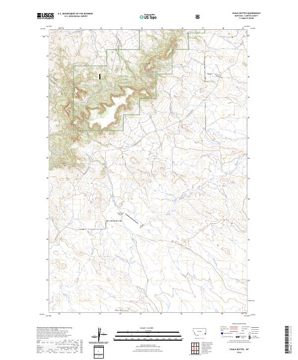
2024 Map of Chalk Buttes
USGS Topo · Published 2024About this map
Custer National Forest encompasses the dominant elevated terrain of the Chalk Buttes in this high-plains landscape. The topography is defined by sharp elevation changes at Trenk Pass and the drainage networks of Buffalo Creek and South Spring Creek, which flow away from the central highlands. Land use in this corner of Carter County is marked by isolated aviation and ranching infrastructure, such as the Laird Ranch Airport, situated on the flatter southern reaches near the Blue Mud Hills. A network of water sources including Foster Spring, Mud Spring, and Birch Spring indicates the critical importance of reliable water in this arid environment. The presence of Chalk Buttes Rd and its associated spur provides the primary access through the draws and passes of the forest boundary.
Find a feature on this map
23 named features on this map. Tap any name to fly to it.
Don’t see what you’re looking for? This feature index may not catch every label — zoom into the map to look around manually.
Map Details
Editions of this 2024 Chalk Buttes Map
This is the sole edition of this map. No revisions or reprints were ever made.
Other maps of this area

1954 · Ekalaka
USGS Topo · 1:250,000

1956 · Ekalaka
USGS Topo · 1:250,000

1958 · Ekalaka
USGS Topo · 1:250,000

1965 · Ekalaka
USGS Topo · 1:250,000

1979 · W L Butte
USGS Topo · 1:24,000

1979 · Dutchman Creek
USGS Topo · 1:24,000

1979 · Blacktail Creek SE
USGS Topo · 1:24,000

1979 · Beaver Flats South
USGS Topo · 1:24,000

1979 · Dead Boy Divide
USGS Topo · 1:24,000

1979 · Ikey Creek
USGS Topo · 1:24,000