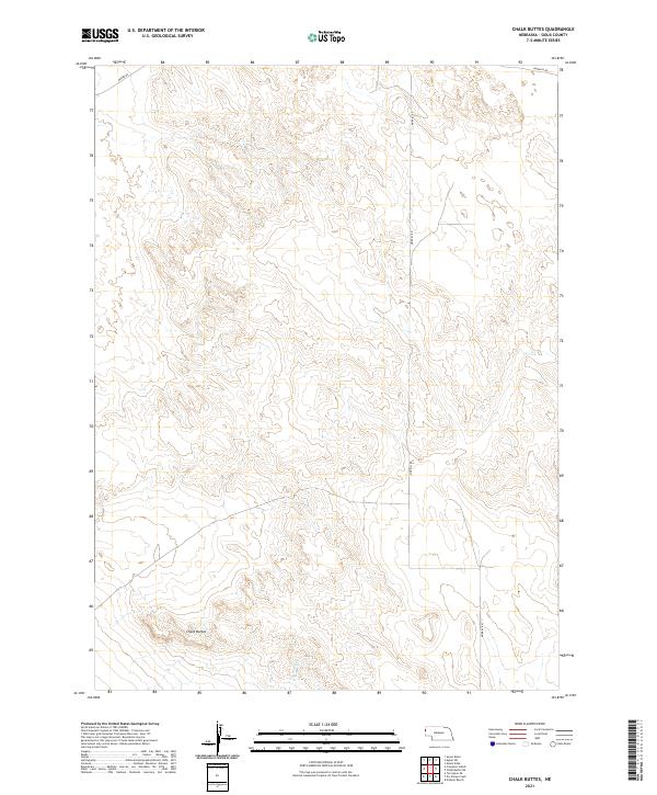
2021 Map of Chalk Buttes
USGS Topo · Published 2021About this map
Chalk Buttes dominates the southwestern corner of this Sioux County landscape, rising as a distinct geological formation above the surrounding high plains. The terrain is defined by a series of intermittent drainages and draws, including Dry Sheep Cr, which snakes through the southern sections. This 2021 topographic survey illustrates a sparsely populated region of western Nebraska where the primary human footprint consists of a geometric grid of sections and a few established rural routes. Local movement is facilitated by several gravel or dirt tracks, including Moore Rd and Murphys Rd along the northern edge, and Morrill Rd, which provides a north-south corridor through the eastern portion of the quadrangle. The map captures the open character of the Nebraska Panhandle, where large-scale land divisions and high-elevation relief dictate the rural structure.
Find a feature on this map
9 named features on this map. Tap any name to fly to it.
Don’t see what you’re looking for? This feature index may not catch every label — zoom into the map to look around manually.
Map Details
Editions of this 2021 Chalk Buttes Map
This is the sole edition of this map. No revisions or reprints were ever made.
Other maps of this area

1896 · Patrick
USGS Topo · 1:125,000

1899 · Whistle Creek
USGS Topo · 1:125,000

1954 · Torrington
USGS Topo · 1:250,000

1955 · Alliance
USGS Topo · 1:250,000

1957 · Alliance
USGS Topo · 1:250,000

1958 · Torrington
USGS Topo · 1:250,000

1958 · Alliance
USGS Topo · 1:250,000

1963 · Chalk Buttes
USGS Topo · 1:24,000
1963 · Torrington SE
USGS Topo · 1:24,000
1963 · Erdman Ranch
USGS Topo · 1:24,000