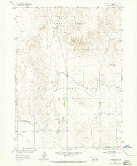
1963 Map of Erdman Ranch
USGS Topo · Published 1965About this map
Sheep Creek and Spottedtail Creek dominate this 1963 landscape, where the high plains of the Sioux Co Scotts Bluff Co line transition into the irrigated agricultural lands of the Dutch Flats. The area's development is deeply tied to water management, visible through the complex network of the Interstate Canal, the Spottedtail Canal, and numerous water control structures like Lateral No 18.
Find a feature on this map
19 named features on this map. Tap any name to fly to it.
Don’t see what you’re looking for? This feature index may not catch every label — zoom into the map to look around manually.
Map Details
Editions of this 1963 Erdman Ranch Map
This is the sole edition of this map. No revisions or reprints were ever made.
Other maps of this area

1898 · Scotts Bluff
USGS Topo · 1:125,000

1899 · Whistle Creek
USGS Topo · 1:125,000

1954 · Scottsbluff
USGS Topo · 1:250,000

1955 · Alliance
USGS Topo · 1:250,000

1957 · Alliance
USGS Topo · 1:250,000

1958 · Alliance
USGS Topo · 1:250,000

1958 · Scottsbluff
USGS Topo · 1:250,000

1963 · Chalk Buttes
USGS Topo · 1:24,000

1963 · Mitchell
USGS Topo · 1:24,000

1963 · Scottsbluff North
USGS Topo · 1:24,000