
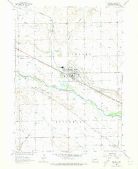
1963 Map of Mitchell
USGS Topo · Published 1965About this map
The North Platte River corridors of Scotts Bluff County define this 1963 landscape, where heavy irrigation engineering has transformed the arid plains into productive farmland. The town of Mitchell serves as a central hub, supported by a dense network of water works including the Mitchell Canal, Tri-State Canal, and Chicago Canal. The historical layering of the region is evident in the alignment of the Oregon Trail and Emigrant Trail south of the river, paralleling the later path of the Union Pacific railroad.
Find a feature on this map
44 named features on this map. Tap any name to fly to it.
Don’t see what you’re looking for? This feature index may not catch every label — zoom into the map to look around manually.
Map Details
Editions of this 1963 Mitchell Map
2 editions found
Other maps of this area

1898 · Scotts Bluff
USGS Topo · 1:125,000

1899 · Whistle Creek
USGS Topo · 1:125,000

1954 · Scottsbluff
USGS Topo · 1:250,000

1955 · Alliance
USGS Topo · 1:250,000

1957 · Alliance
USGS Topo · 1:250,000

1958 · Alliance
USGS Topo · 1:250,000

1958 · Scottsbluff
USGS Topo · 1:250,000

1960 · Stegall
USGS Topo · 1:24,000

1963 · Scottsbluff South
USGS Topo · 1:24,000

1963 · Scottsbluff North
USGS Topo · 1:24,000