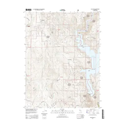
2015 Map of Challenge
USGS Topo · Published 2015About this map
Challenge and Sharon Valley occupy a high-elevation corridor in the northern Sierra foothills, where the Plumas National Forest and Tahoe National Forest meet. The landscape is defined by the steep drainage basins of Indian Cr and the New Bullards Bar Reservoir, which occupies the eastern edge of the quadrangle. Several small settlements including Greenville and Fountain House are connected by mountain thoroughfares like Marysville Rd and La Porte Rd.
Find a feature on this map
88 named features on this map. Tap any name to fly to it.
Don’t see what you’re looking for? This feature index may not catch every label — zoom into the map to look around manually.
Map Details
Editions of this 2015 Challenge Map
This is the sole edition of this map. No revisions or reprints were ever made.
Other maps of this area

1888 · Smartsville
USGS Topo · 1:125,000

1888 · Bidwell Bar
USGS Topo · 1:125,000

1891 · Bidwell Bar
USGS Topo · 1:125,000

1891 · Smartsville
USGS Topo · 1:125,000

1892 · Smartsville
USGS Topo · 1:125,000

1893 · Bidwell Bar
USGS Topo · 1:125,000

1894 · Smartsville
USGS Topo · 1:125,000

1895 · Bidwell Bar
USGS Topo · 1:125,000

1895 · Smartsville
USGS Topo · 1:125,000

1897 · Bidwell Bar
USGS Topo · 1:125,000